Emmanuel Ebhodaghe
Urban & Regional Planning Technician | Transportation Planner
Urban and Transportation Planner with 2+ years of consulting experience supporting municipal traffic studies, parking analysis, land-use assessments, and development review. Skilled in drone-assisted data collection, AI-driven traffic analytics, and translating complex findings into clear, decision-ready reports for municipal stakeholders.
About Me
I am an Urban and Transportation Planner with advanced education in Geographic Urban & Regional Planning and a strong academic record (GPA: 3.7/4.0). With a Bachelor of Engineering in Civil Engineering and over 2 years of consulting experience, I bring a unique blend of technical engineering knowledge and planning expertise to every project.
My work focuses on leveraging innovative technologies like drone-assisted data collection and AI-driven analytics to support municipal traffic studies, parking analysis, land-use assessments, and development review. I am passionate about translating complex technical findings into clear, actionable insights that drive better decision-making for sustainable urban development.
Technical Expertise
Proficient in AutoCAD, Civil 3D, ArcGIS Pro, SketchUp, and advanced data analysis tools. Specialized in drone-assisted data collection and AI-driven traffic analytics for municipal planning.
Planning Focus
Specializing in transportation planning, traffic studies, land-use assessments, parking analysis, and site planning with proven ability to improve operational efficiency and data quality.
Innovation & Impact
Delivered projects achieving measurable results: 60% reduction in data collection time, 45% estimated reduction in truck-related carbon emissions, and 38% improvement in stormwater management.
Featured Projects
Explore some of my notable urban planning work
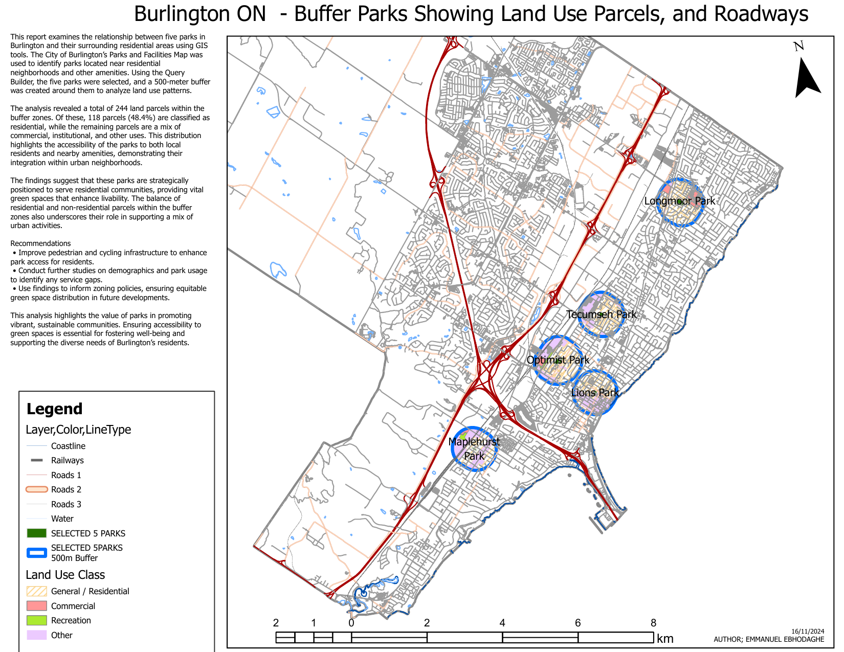
Burlington Parks & Land Use Buffer Analysis
This GIS project examines the relationship between five parks in Burlington, Ontario and their surrounding residential areas. Using the City of Burlington's Parks and Facilities Map, I identified parks located near residential neighborhoods and other amenities. The analysis utilized Query Builder to select five parks (Longmoor Park, Tecumseh Park, Optimist Park, Lions Park, and Maplehurst Park), creating 500-meter buffer zones to analyze land use patterns and park accessibility.
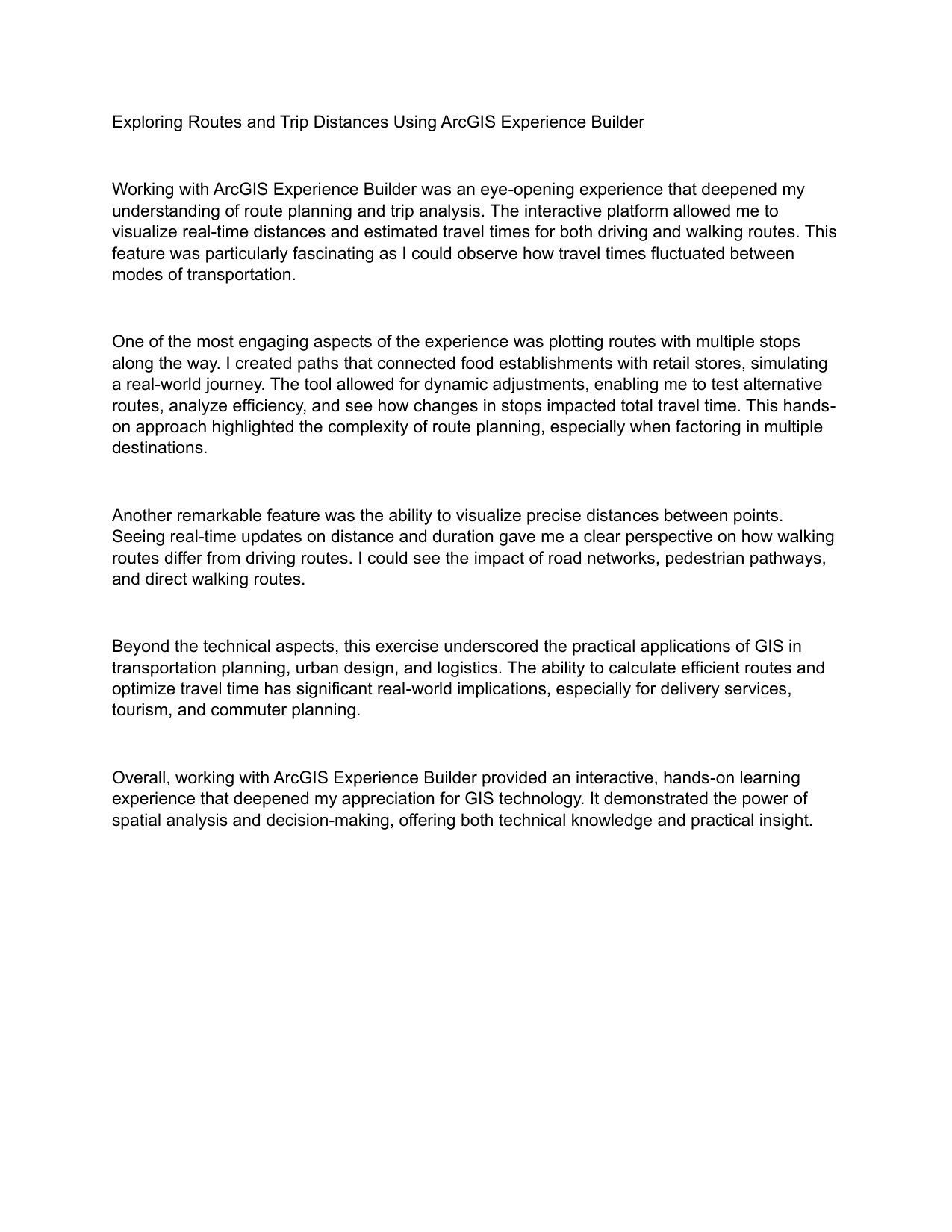
Route Planning & Trip Distance Analysis with ArcGIS Experience Builder
An interactive GIS project using ArcGIS Experience Builder to explore route planning and trip analysis. This project involved visualizing real-time distances and estimated travel times for both driving and walking routes, demonstrating the complexity of multi-modal transportation planning. The platform enabled dynamic route plotting with multiple stops, connecting food establishments with retail stores to simulate real-world journey scenarios.
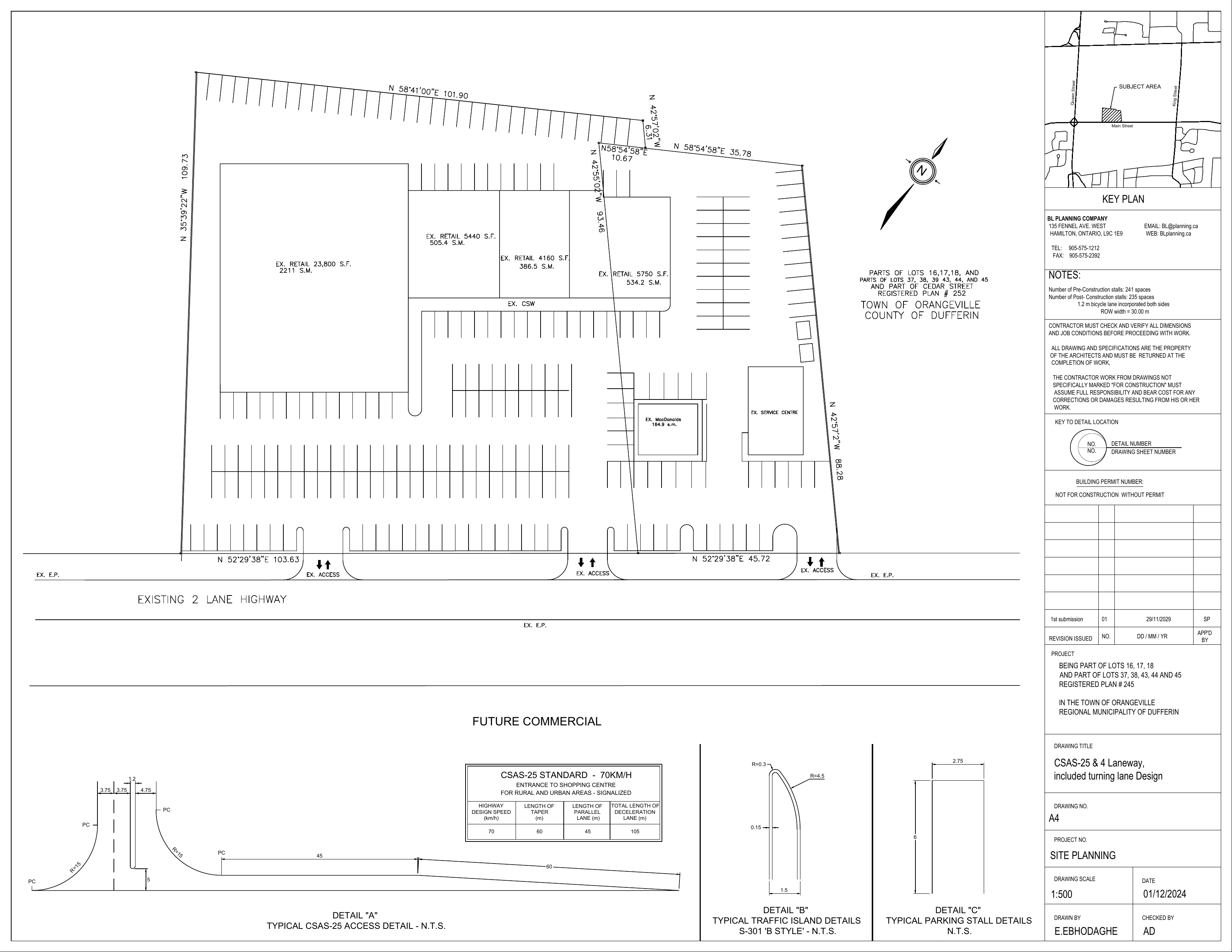
Commercial Development Street Design - King & Queen Street Corridor
A comprehensive street design project for a commercial development area in Orangeville, Dufferin Region. The project involved redesigning the King Street and Queen Street corridor to accommodate both vehicular traffic and active transportation while maintaining adequate parking for the future commercial development. The design balanced pre-construction and post-construction parking requirements while integrating sustainable transportation infrastructure.